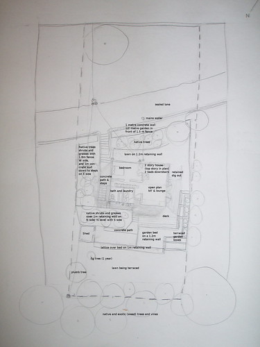
Our first assignment for the permaculture design course has been to draw a base map.
A base map is a drawing that captures everything that is in place already on a property or space. It includes buildings, fences, trees, hedges, pathways and driveways, power lines and pipes... things that are in place.
Here's my Base Map:
Google maps does a pretty good job at capturing it too...
View Larger Map
so, we're on a steep NNW facing block that is reasonably sheltered from all winds, although the cold Southerlies can touch our front pretty hard... but now I'm starting to get Sector Analysis about it, which is what I should be focusing on this week:
A sector analysis map is a drawing that depicts what is happening in that base. What is the sun's path, what are the wind and rain directions, where are the main areas of people activity, where are the shade areas.
0 comments:
Subscribe to:
Post Comments (Atom)